


In retrospect, Idalia turned out to be far less deadly and destructive than predicted the day before its heralded arrival. A year ago, Hurricane Ian plowed into Fort Myers, FL and Sanibel Island leaving behind damage not yet completely recovered. Hurricane Michael flattened Mexico Beach, southeast of Panama City (also close to Florida's Big Bend) five years ago. Each storm far exceeded the death toll and destruction left in the wake of Idalia.
Are hurricanes growing worse? Such an assertion has been a familiar theme in recent wall-to-wall media coverage of the first hurricane to arrive on US shores this season.
To drive home its central message, the AP in an early version of a standing story, before the storm blew ashore near Cedar Key, offered up a supposition that no hurricane had ever made landfall in that particular part of Florida, after having first crossing into the bay from the Gulf of Mexico. The categorical term "unprecedented" appeared no less than three times in the text.
Whether such an occurrence has happened before may or may not be provable, but it should make little difference one way or the other in the conversation over how many recent severe weather events of the past decade were truly “unprecedented,” many as the AP would dearly like its readers to believe.
It should be apparent to any but the most recalcitrant that the track of a particular hurricane is unique unto itself. There are, of course, some preferred paths followed in part by individual hurricanes during the past hundred years that the tropical storms have been charted. But, as with the proverbial snowflakes, no two travel exactly alike.
Tropical weather expert, Joe Bastardi of WeatherBELL Analytics, LLC closely follows the preferred paths of previous hurricanes and can claim a certain amount of success at predicting their frequency and the paths prospective hurricanes may tend to follow even before the advent of an upcoming season.
His father, a former meteorologist, is said to have predicted the path followed by the 1938 East Coast hurricane (nicknamed the “Long Island Express”) before the National Weather Service adopted the practice of assigning given names to major tropical storms. The Bastardis have had the acumen for analyzing ocean circulation patterns and using them as a predictive guide to forecast hurricanes without making themselves slaves to the models often more favored by other analysts.
Recommended

The AP’s hurricane reporters, apparently none of them professional meteorologists, depend on making phone calls to a stable of academic experts for opinions and historical data on storm records and the like. One of several AP news bulletins Wednesday drew close attention to the concurrence of the arrival of Hurricane Idalia with the full moon of August 30. And as it turned out, it was the second full moon of the month, bestowing upon it the distinction of being a “blue moon.”
Being a blue moon was merely a coincidence to be added as media hype. It had absolutely no bearing on the destructive force of the storm soon to arrive from the Gulf of Mexico. But what could have had an effect was the position of the moon in its current stage of revolution around Planet Earth. It is at its closest distance to Earth and referred to as a "Super Moon." That fact means that it is about 7% closer than when at its average distance, rendering the gravitational force of attraction between the two bodies greater.
The added gravitation also means that at high tide the storm surge accompanying an arriving tropical storm would also be greater, and contribute to as much as a foot higher level than a normal high tide along the portion of the Florida coast where Idalia was expected to arrive. But as matters turned out, Idalia made landfall at low tide. The result was a lower tidal surge than predicted the day before. And at actual high tide some six hours later the storm front had moved well ashore where gravity plays a negligible role affecting storm surges.
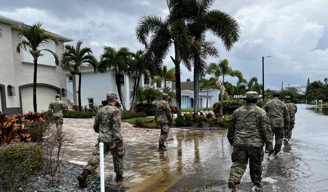
The strength of Idalia’s wind field quickly dropped from a Category 3 at landfall to barely a Category 1 with 90 mph maximum sustained winds as it moved northeastward overland toward Georgia and the Carolinas. Idalia continued as a potent rain-maker creating flash floods as heavy rains continued to fall along its path.
But national media coverage, as exemplified by the AP and other outlets, failed to present a balanced coverage and often appeared to over-dramatize and amplify the worst aspects of this, the first US land-falling hurricane in the 2023 season. Idalia is the first, but likely not the last, in a season NOAA experts expect to be active. No doubt the media will have much more to say about its successors.
As active as 2023 may turn out, it is unlikely to be as active for Florida as was 2004. Within less than the span of six weeks, South Floridians experienced the passage of Charlie, Frances, Ivan and Jeanne, four major hurricanes leaving many of the Treasure Coast’s homes covered with blue plastic sheeting awaiting arrival of the roofers.
The following season, 2005, was the most active in the Atlantic basin since accurate records had been kept. Some 28 major tropical storms were finally charted, with Wilma having been the only hurricane to make landfall on Florida that year. Katrina came ashore near New Orleans in August 2005.
The coverage being accorded the 2023 season gives the impression that hurricanes are becoming more frequent and stronger with the passage of time. But analysis by experts like Ryan Maue going back a century shows past decades such as the 1940s and 1960s spawned more major tropical storms that made land-fall than during the previous two recent decades (since 2000). Statistical analysis of the time-line shows no increase in over a century.
Major hurricanes are no more frequent or damaging today than what they have been in the historic past.
William D. Balgord, Ph.D. (geochemistry), heads Environmental & Resources Technology, Inc. in Middleton, Wisn.


Join the conversation as a VIP Member